Liverpool Conservation Areas
Liverpool Heritage Bureau
Liverpool City Planning Department
Wilberforce House
25 The Strand
Liverpool L2 7QA
Copyright Information

|
Liverpool Heritage BureauThe Heritage Bureau was set up in 1971 by the Liverpool City Council as a result of the considerable interest and concern of the Local Authority, public organisations, learned societies and private individuals in the preservation and conservation of Liverpool's natural and man-made environment.¤ Liverpool Heritage Bureau no longer exists ¤Current Information |

|
Castle Street
Rodney Street
Mount Pleasant
William Brown Street
Albert Dock
Canning Street
Garden Estates Ogden Close
Princes Rd
Princes Park Sefton Park
Lark Lane
Grove Park Fulwood Park
Childwall Abbey Mossley Hill
West Derby Gateacre Woolton
Wavertree Garden Suburb
Walton on the Hill
Grassendale & Cressington Parks
St Michael's Hamlet
Other links...
Top
Introduction (This was written in 1979)
The Civic Amenities Act of 1967 introduced the idea of the Conservation Area - 'An area of special architectural or historic interest, the character or appearance of which it is desirable to preserve or enhance.' Since that time Liverpool has pursued an active policy of conservation in the historic areas of the City. Castle Street was the first Conservation Area, designated by the City Council in 1968, to be followed by a wide variety of areas, from Georgian streets and village centres to Victorian parks and twentieth-century garden suburbs. Liverpool now has 26 Conservation Areas, eleven of which are considered 'outstanding' in the national context by the Historic Buildings Council of the Department of the Environment.
The designation of a Conservation Area means that the City Council has to give special care to the area as far as future development is concerned. It is expected to take positive action to improve the area - for instance by the restoration of buildings, traffic management, pedestrianisation, or landscaping. New buildings and alterations should fit in with the existing character of the area, and so particular attention has to be paid to. design, scale, and materials. Additional powers of planning control are also in force in the majority of the areas.
In order to publicise and thereby hopefully create a greater appreciation of the City's Conservation Areas, the Liverpool Heritage Bureau requested the City Planning Officer to produce an illustrated book on them - Liverpool Conservation Areas is the result.
 Each Conservation Area is described in the order of designation by the City Council, the description taking the form of a plan, a short written commentary and a number of line drawings.
Although the majority of the Conservation Areas contain buildings 'listed' as of special architectural or historic interest, not all of them do. Similarly not all the buildings illustrated in this publication have 'listed' status. The illustrations were selected purely to convey the general character of each Conservation Area. Readers requiring information on 'listed' buildings in the City, whether in Conservation Areas or not, are referred to Buildings of Liverpool which is also published by the Liverpool Heritage Bureau.
It is hoped that Liverpool Conservation Areas will not only prove interesting and enjoyable to read but will also encourage the reader to study the various areas at first hand by walking round them. The book has been written, illustrated and graphically designed by members of the City Planning Department.
CONSERVATION AREA 1Castle Street |
|
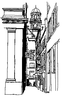
This is the traditional business centre of Liverpool and remains a unique example of Victorian and Edwardian commercial development. The focus is Castle Street itself, with the fine Georgian Town Hall by John Wood of Bath, set at the north end of a monumental axis which previously stretched to the former Customs House at Canning Place. The Town Hall also forms the junction of Water Street and Dale Street, the former leading down to the Pier Head and containing the spectacular Oriel Chambers of 1864. At the Pier Head are the Royal Liver, the Cunard, and the Mersey Docks and Harbour |
Company buildings, collectively expressing the great imperial spirit of Edwardian Liverpool, and giving the City its famous skyline. Also included within the designated area are Dale Street with a mixture of fine classical and gothic commercial buildings, North John Street and Victoria Street, stretching as far as the Queensway motor tunnel entrance.
The area contains almost 100 buildings which are 'listed' for their architectural or historic interest. |

Oriel Chambers

Oriel Chambers, (a Grade 1 Listed Building), designed by the virtually unknown Liverpool architect, Peter Ellis, and built in 1864, is one of the most significant buildings of its date in Europe. Its functional design and revolutionary use of glass and cast iron aroused a great deal of controversy in its day - it was described as a 'great abortion' and an 'agglomeration of plate glass bubbles'.
Dale Street was originally the principal route into the town centre from Manchester and London, with numerous taverns and inns between the Town Hall and the eastern bridge over the brook which ran along the line of Byrom Street and Whitechapel into the Pool.
Below, the west side of Castle Street - a complete Victorian commercial street frontage


Contents
CONSERVATION AREA 2Rodney Street Map |
|
This famous area of Liverpool contains three separate elements: Rodney Street itself, Hope Street, and the Anglican Cathedral. Rodney Street, built between 1780 and 1840, is one of the finest examples of a Georgian street in the country and is a reminder of the style of life led by Liverpool merchants and business men of that time.
Many of the houses have associations with famous people, and the quality of detailing of windows, doorcases, steps, balconies and other features both external and internal deserve close attention. Hope Street contains a variety of building types, the finest group being Gambier Terrace dating from the 1830s. This was intended to stretch the full length of St. James Cemetery, | |
|
its yellow brick continuation being a later Victorian addition.
The Anglican Cathedral, St. James Cemetery,
St. James Church and St. Luke's Church complete the Conservation Area.
The Rodney Street Conservation Area was designated on 31 July 1968 and extended on 17 November 1976. It is considered 'outstanding' in the national context by the Historic Buildings Council. |
|


There are many subtle variations in the design of doorways in Rodney Street. This one has Doric columns set within a brick arch, a pattern which, as well as appearing elsewhere in Rodney Street and Liverpool is also found on many Georgian houses in Dublin. Contents |
| St. Andrew's Presbyterian Church of Scotland, designed in 1823 by John Foster, Junior. |

|
| Giles Gilbert Scott's Anglican Cathedral from Upper Parliament Street, with the arched entrance to John Foster's St. James' Cemetery on the right, and the earlier steps (centre) up to St. James' Walk and the Mount, laid out in 1767. |